

In Tokyo, It’s quite easy to use the JR Trains, especially the main Yamanote Line.
But there are times where you need to get to an area that is only served by a metro subway line which is NOT a JR East Train and you will need to have a purchased ticket or even better, an IC card such as a Suica or Pasmo Card.
And this is where planning your vacation is important and utilizing Google Maps or Hyperdia is very helpful and why it’s always recommended to rent a pocket WiFi during your trip.
One thing that you will get the hang of is remember a metro line via its name and helps to know the color. For example Marunouchi Line is red, Hibiya Line is gray, Chiyoda Line is green.
And it’s important to note that most Japanese know the name of the “Metro Line”, because the word “Subway” is not used in Japanese conversation in terms of metro, but the word is used mostly to describe the restaurant, “Subway Sandwiches”.
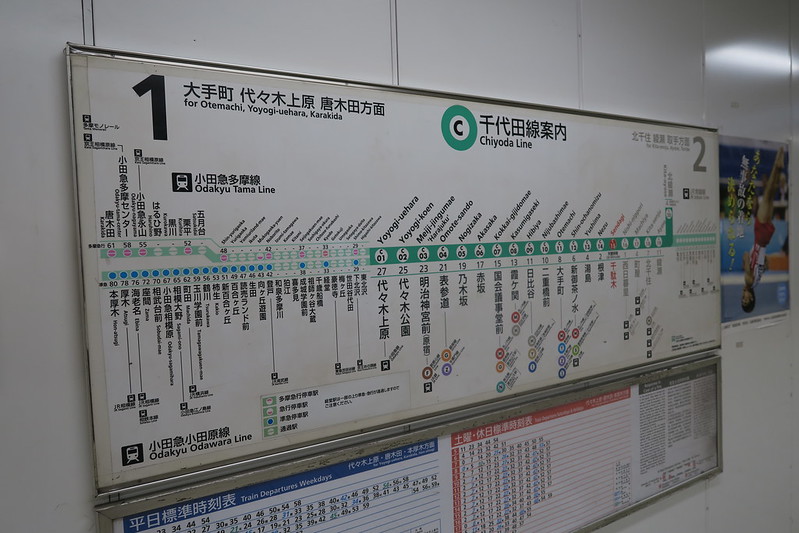
So, these are signs that you will usually see for a line. But let’s say your pocket WiFi battery died or you need to recharge it and have no access to your smartphone or tablet.
This is where getting a Tokyo Subway Route Map is important. You can pick this up at most station gates.
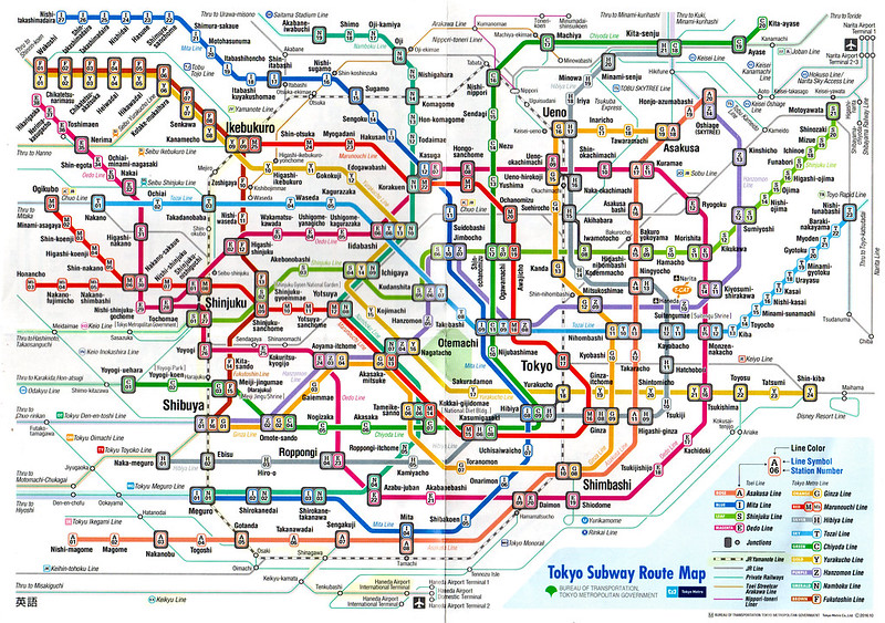
You can click here to download a larger version.
You can have the person at the station help you, but if you know the area, first find it in the map.
EXAMPLE 1: UENO STATION TO NOGIZAKA STATION
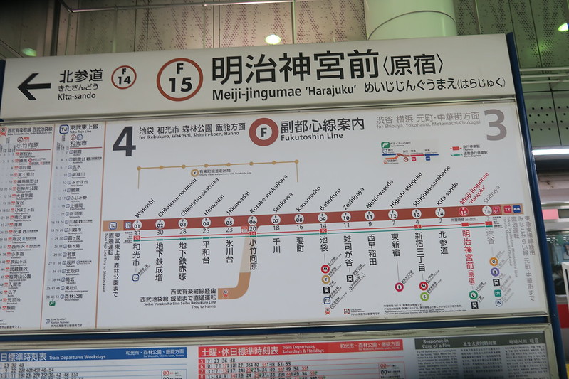
Let’s say that you are in Ueno (top middle right) and you want to go to the Tokyo Midtown area in Akasaka (which is in the Chiyoda ward – GREEN) and it’s nearest to Nogizaka Station (C-05) (look on the middle left area).
You notice on the map, Ueno Station has G-16 (Ginza Line – Yellow) and H-17 (Hibiya Line – Gray). Now following those color lines, which one would take you to the green Chiyoda Line area where Nogizaka Station is located?
As you see, the Ginza Line (G-16) will take you all the way to Omotesando Station (G-2). So, you just need to make sure you take the line that is going backward from G16 and will make 15 stops to G-2, Omotesando Station).
Get out of the Ginza Line and take the green Chiyoda Line metro from C04 and one stop after is Nogizaka Station (C-05).
See how easy that is?
EXAMPLE 2: AKASAKA to NAKA-MEGURO
OK, you are done shopping at Tokyo Midtown in Akasaka but now you want to go to Naka-Meguro (bottom left), H-01 (Gray, Hibiya Line).
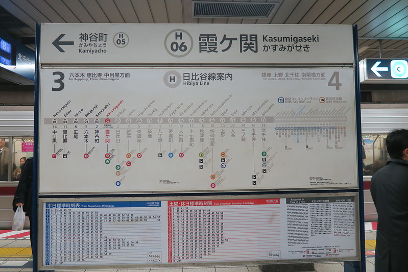
So, you ask yourself, looking at the green Chiyoda Line, which station will take you to the Hibiya Line?
You can see either Nogizaka Station (C-05) or Akasaka (C-06) will take you to Hibiya (C-09). You can then travel a few stops to Hibiya and take the Hibiya Line (H-07) all the way back to Naka-Meguro (H-01).
EXAMPLE 3: NAKA-MEGURO to IKEBUKURO
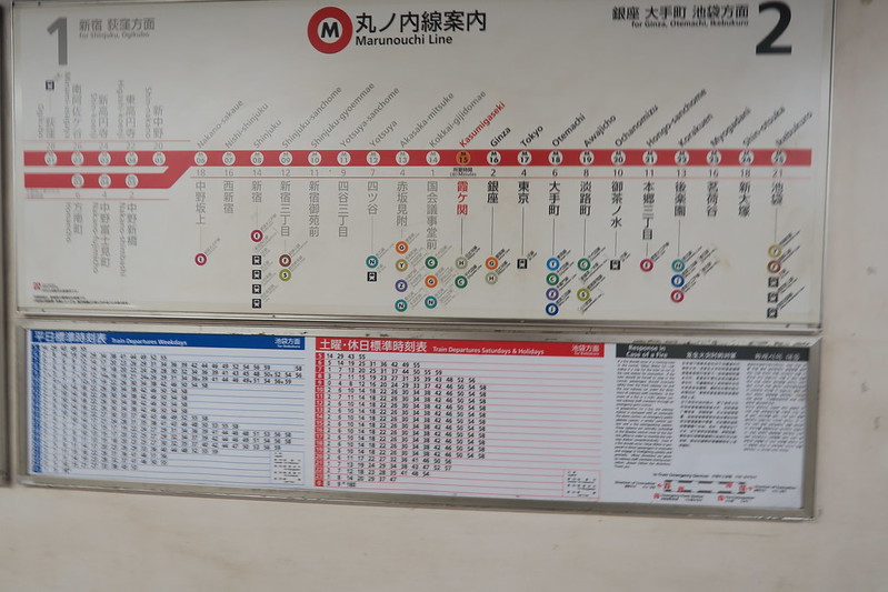
And for our last example, let’s say you want to go from Naka-Meguro (H-01) (Gray, Hibiya Line) all the way to Ikebukuro (Top left of map). As you can see, there are only three metro – Y09 (Yurakucho Line- dull yellow), F09 (Fukutoshin Line – Brown) and M25 (Marunouchi Line, Red).
So, following the gray color line from Naka-Meguro, which one will find a dull yellow, brown or red line? You see that Kasumigaseki Station (H06) has a Marunouchi Line (M15). So, you ride six stops to Kasumigaseki Station, get out and take the red Marunouchi Line from M15 and ten stops all the way to M25 to Ikebukuro.
And that’s it! At first, looking at this map may seem a bit difficult but the more you look at it and see how things work, once you know the Metro Line and its color, it is much easier to follow.